Shanghai Maps
This page introduces Shanghai on map, including Shanghai city map, suburb maps, Shanghai districts map, Shanghai attractions maps… If visitors want to be guided more easily, they are suggested to enlarge and download Shanghai maps.
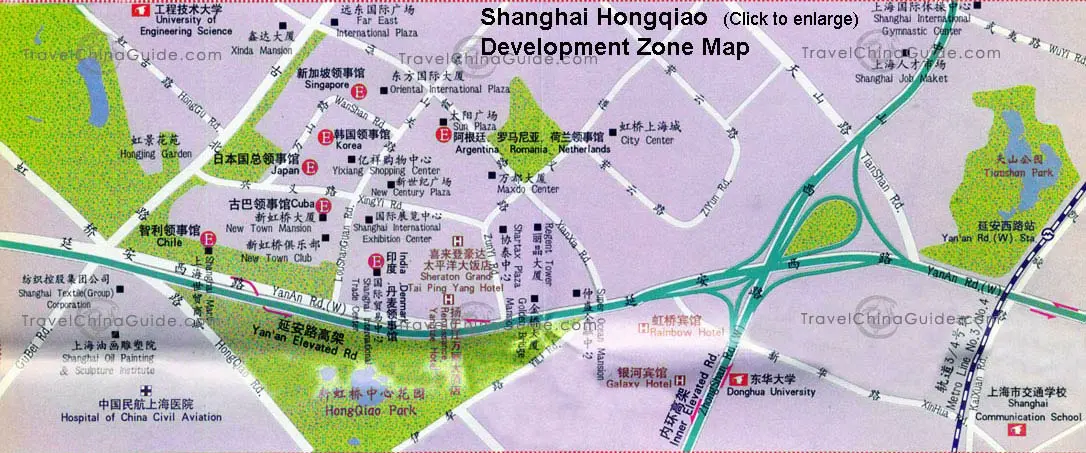
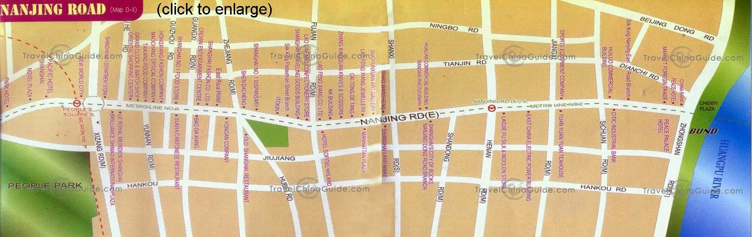
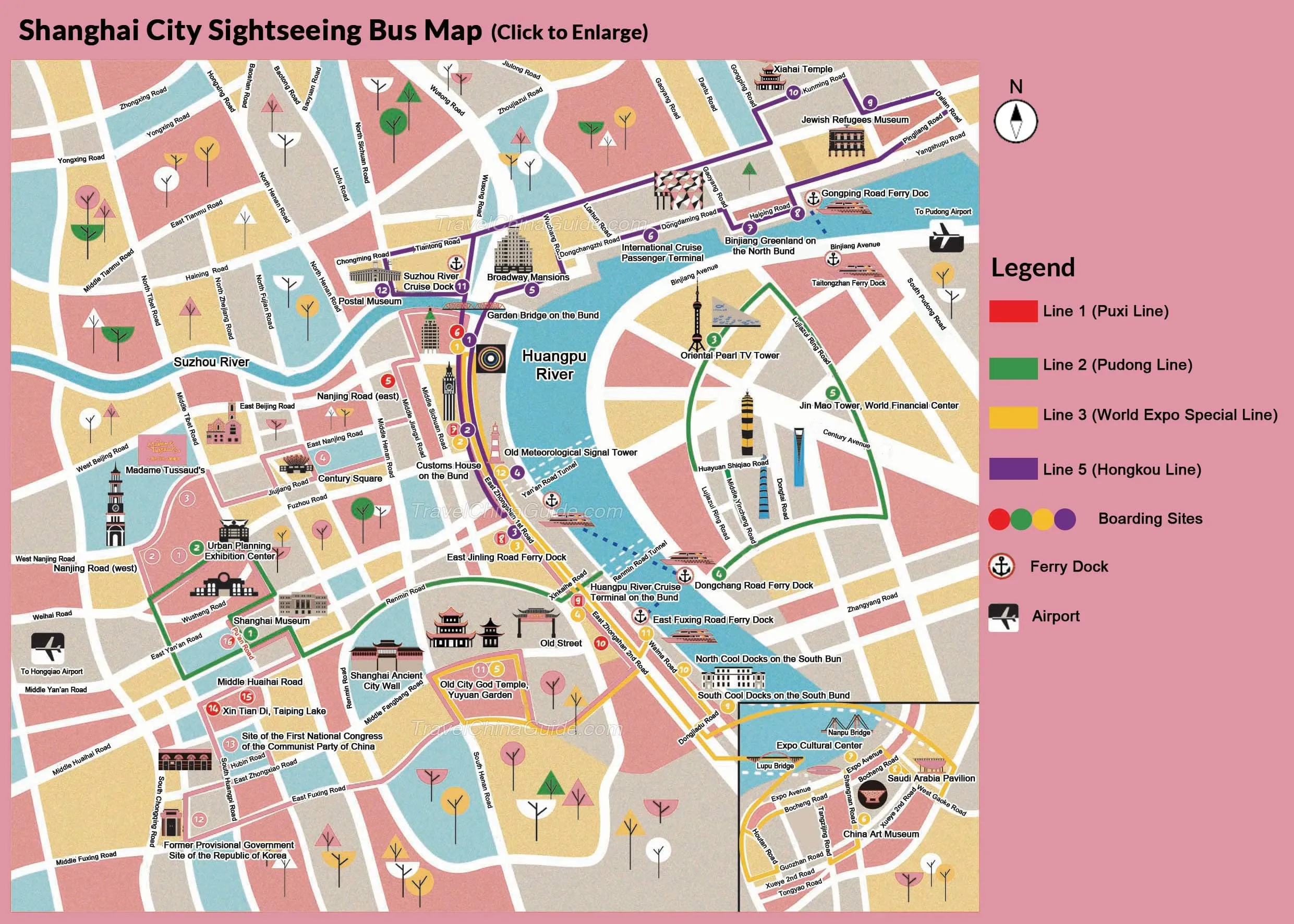
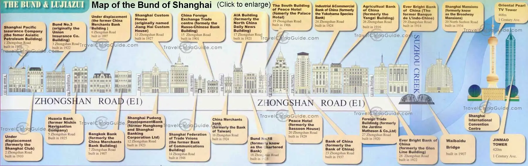
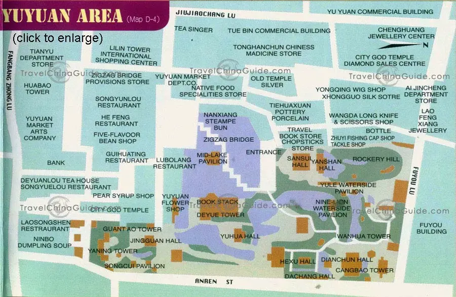
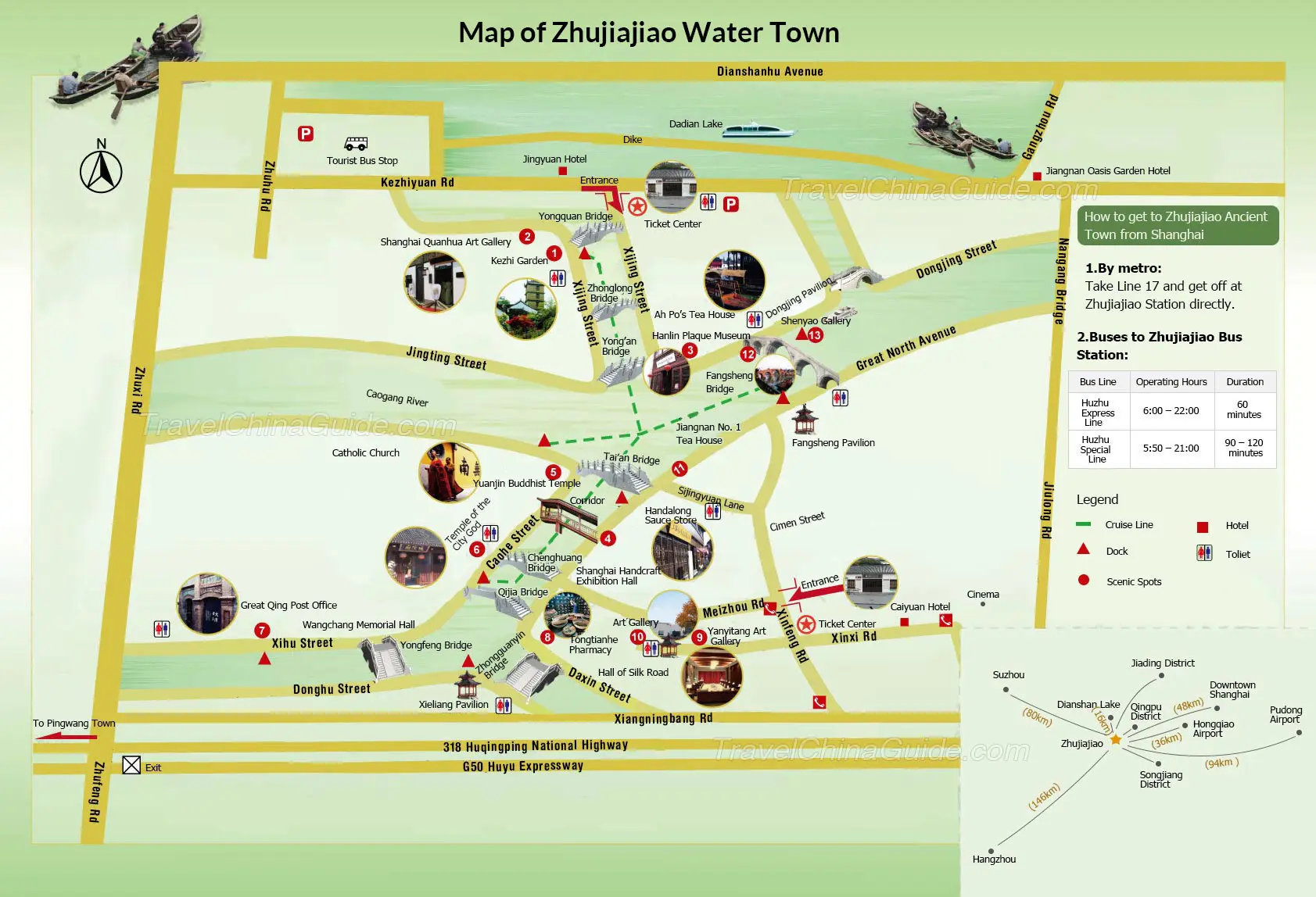
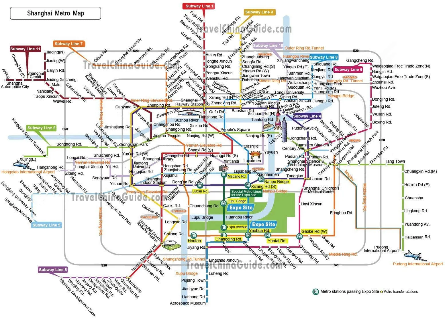
 Click to enlarge it.
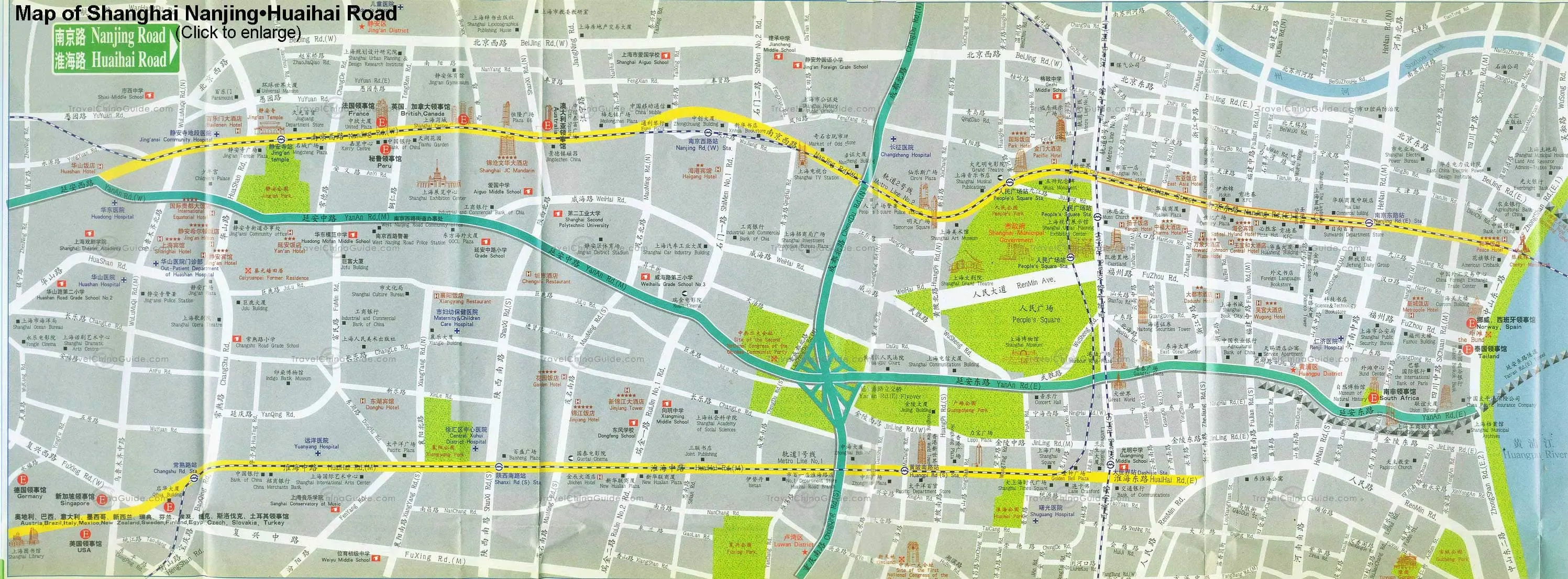
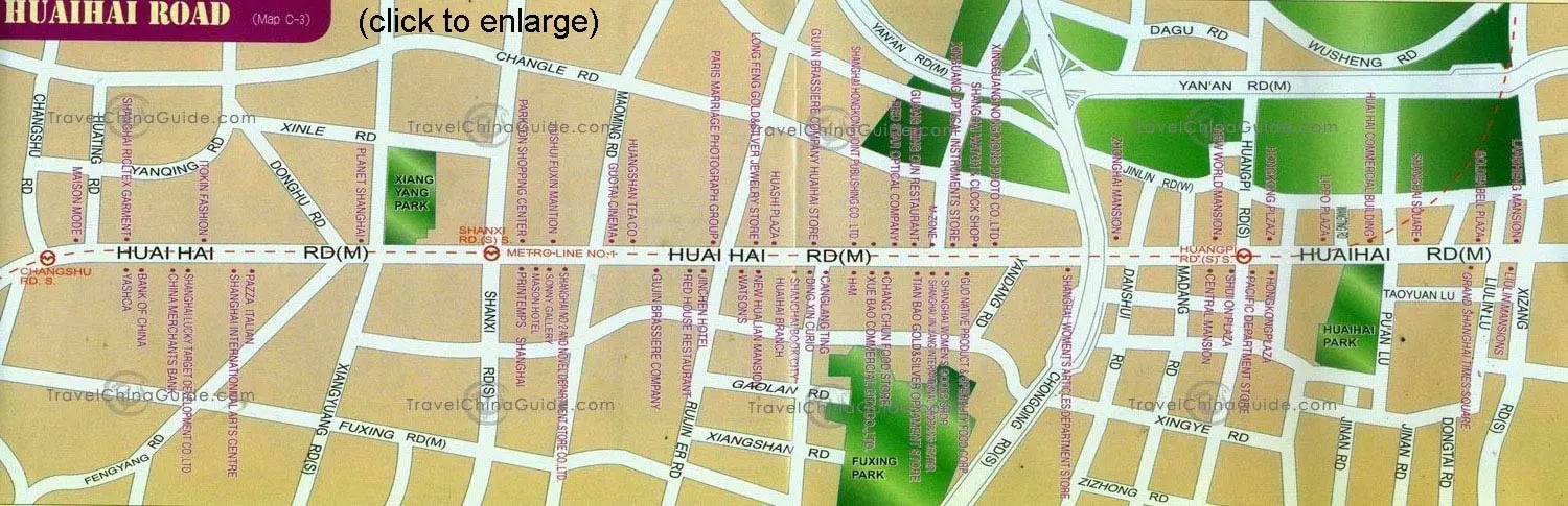
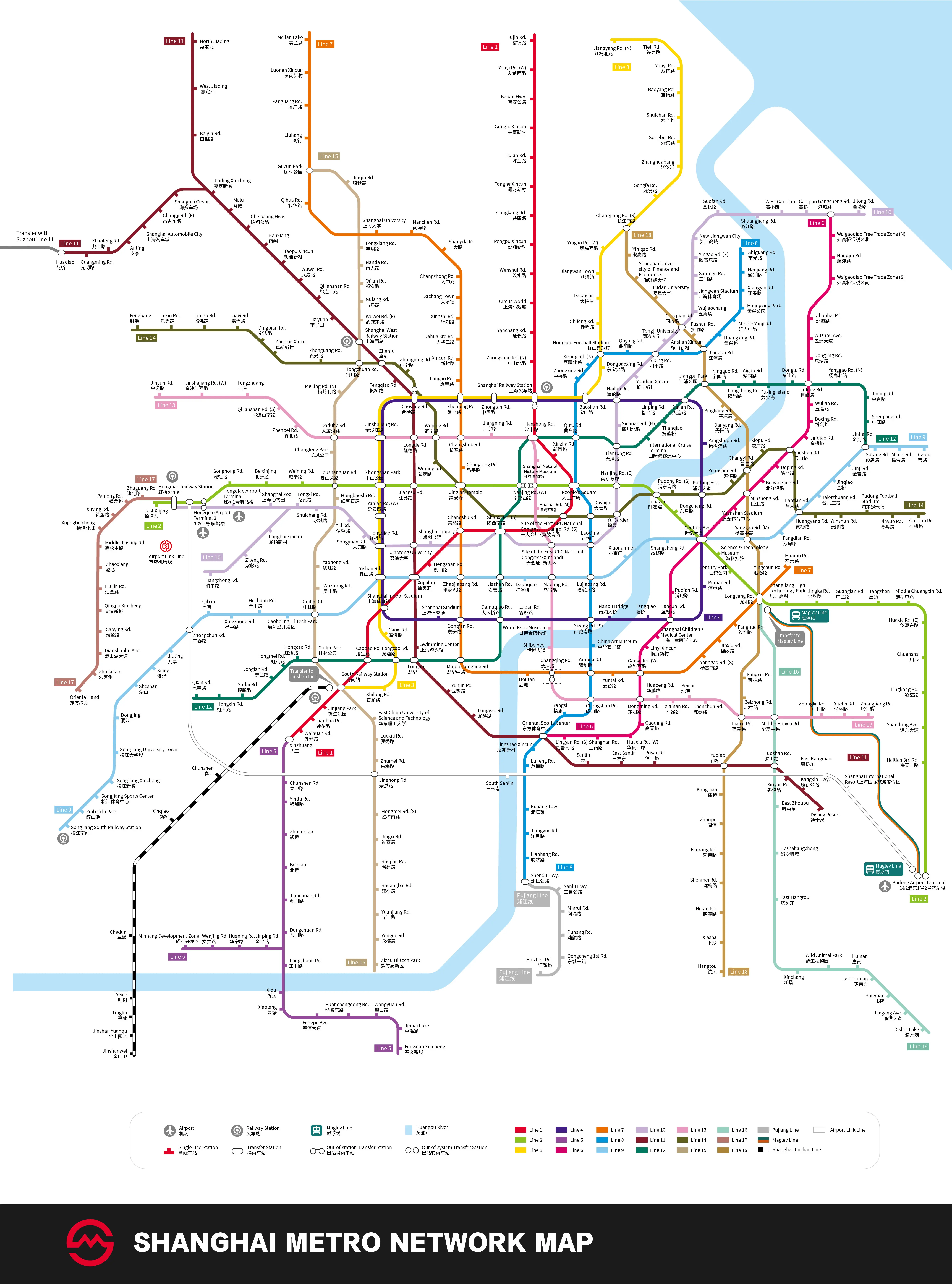
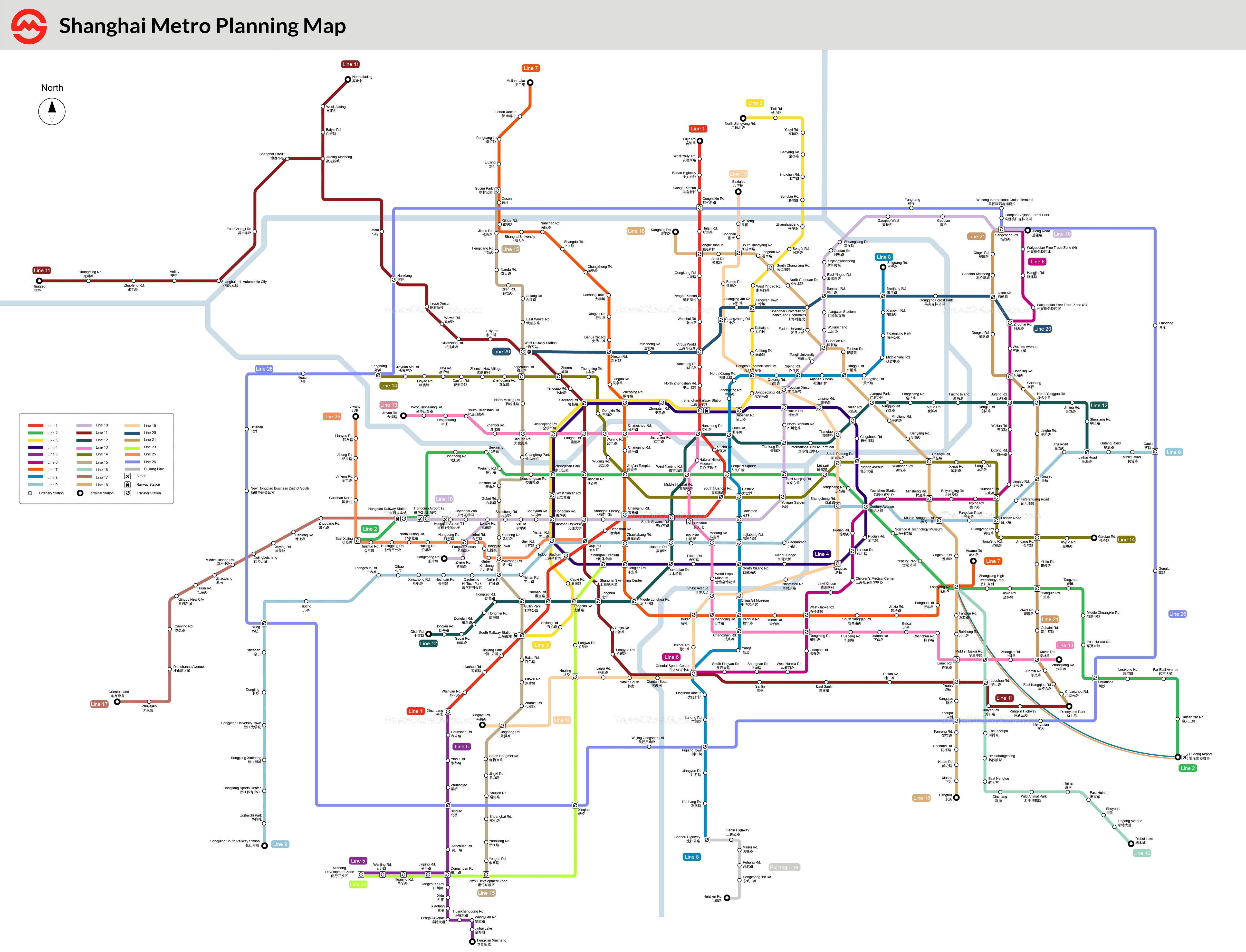
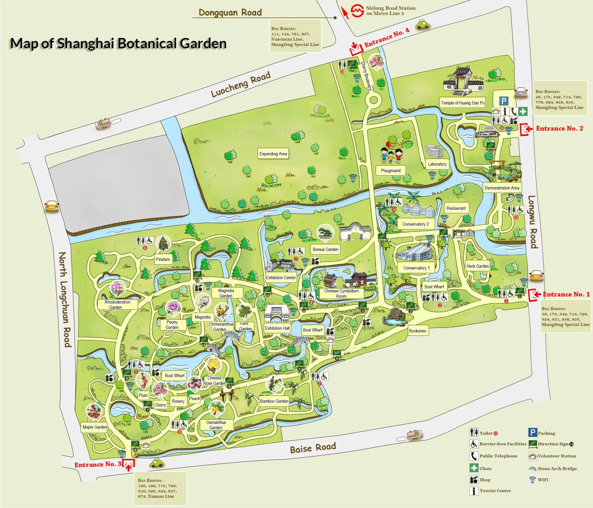
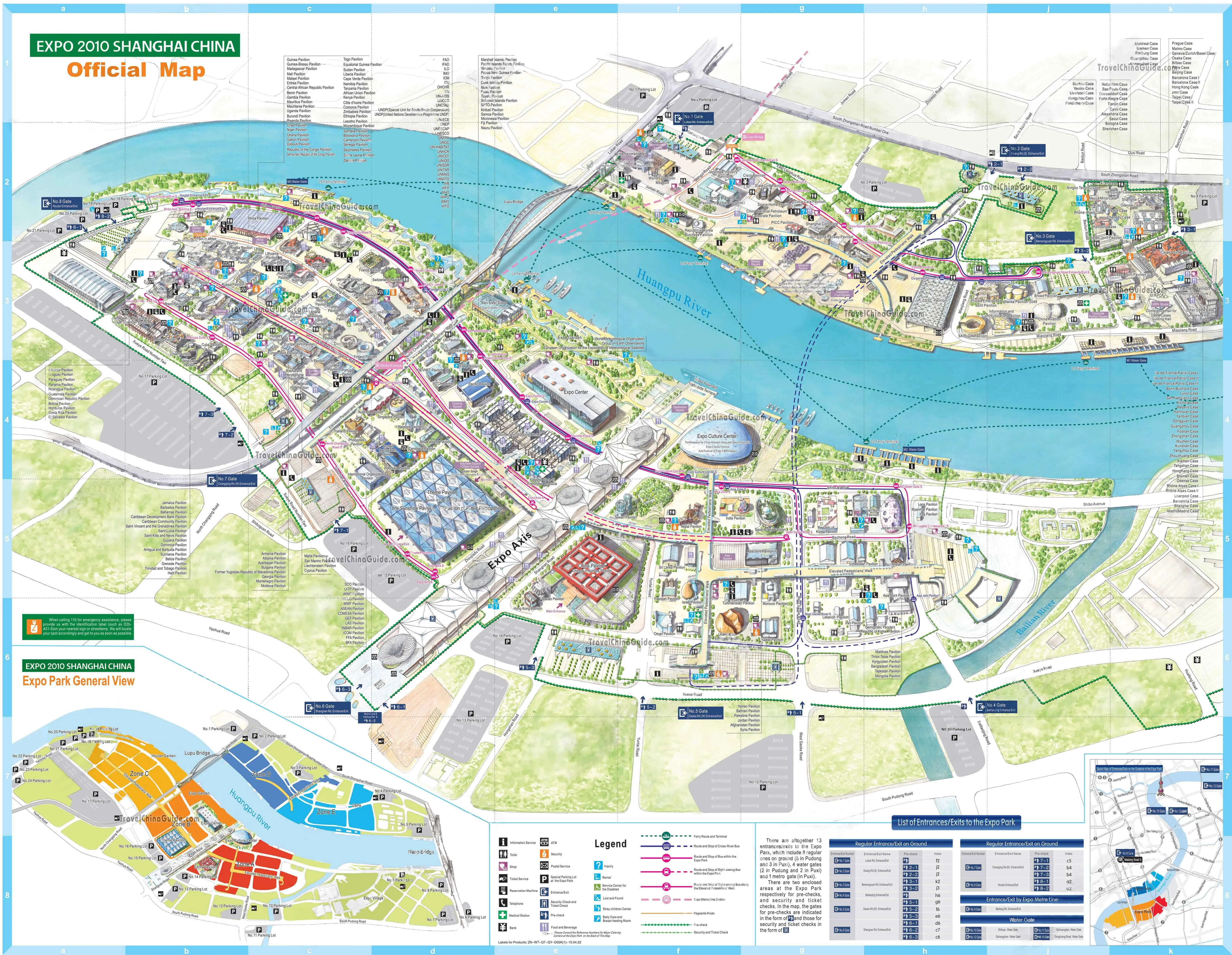
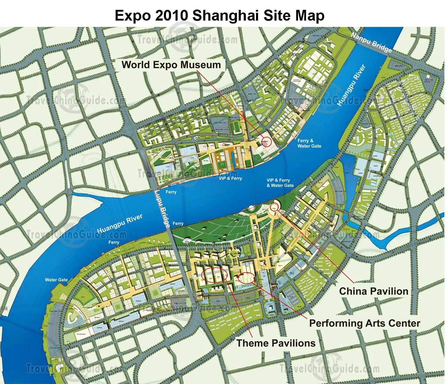
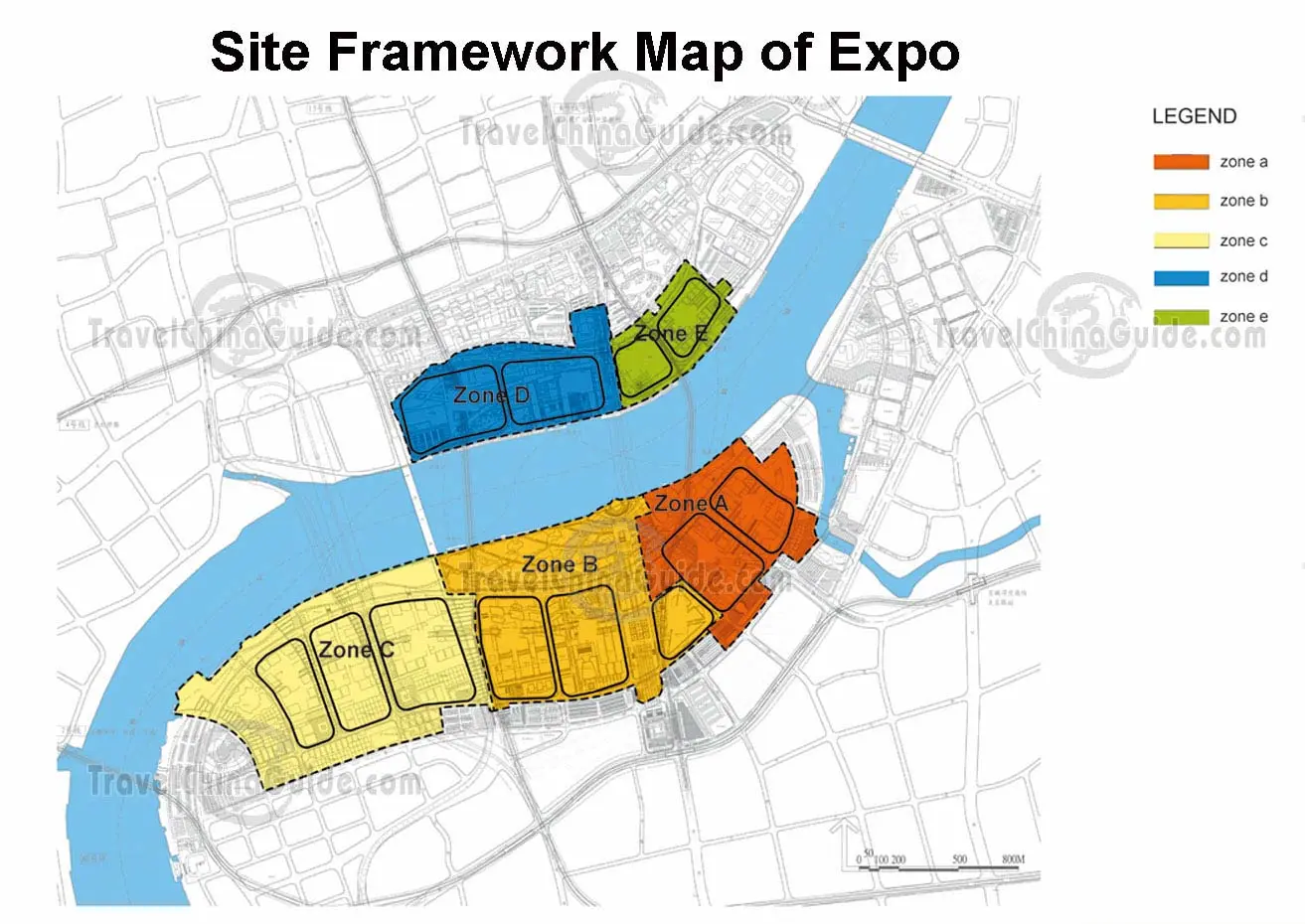
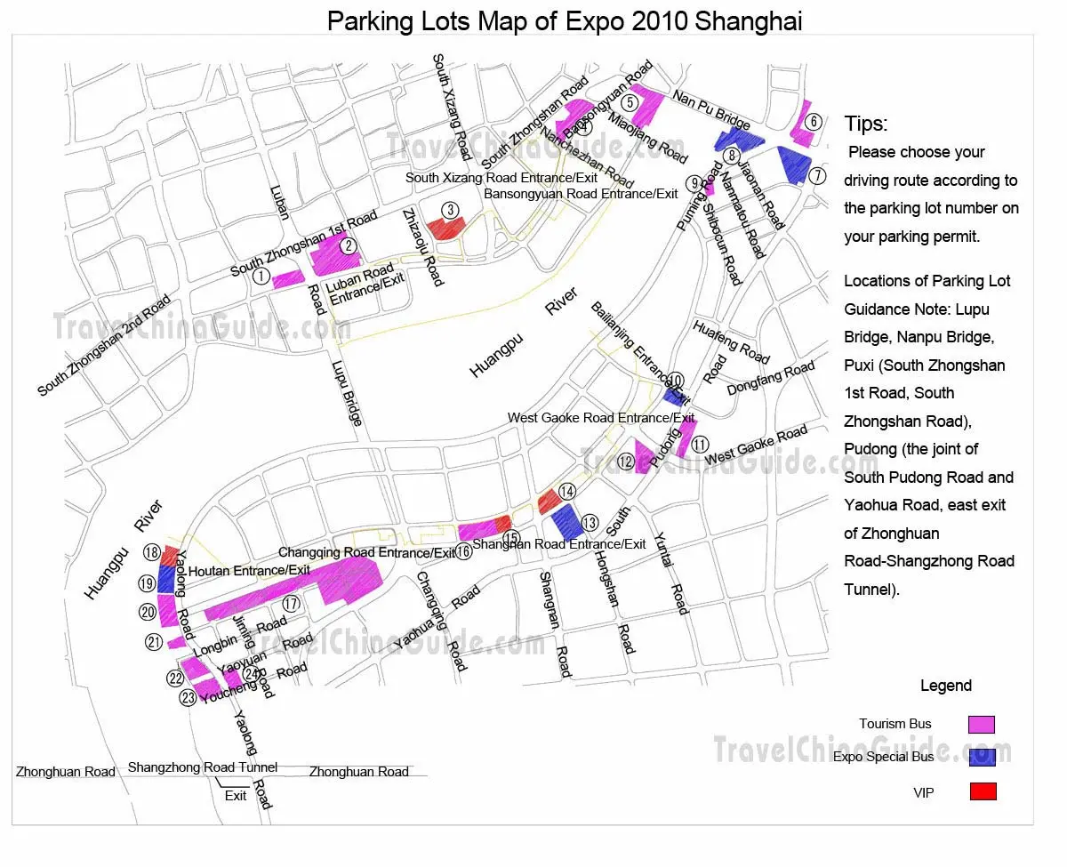
 More Shanghai Metro Maps
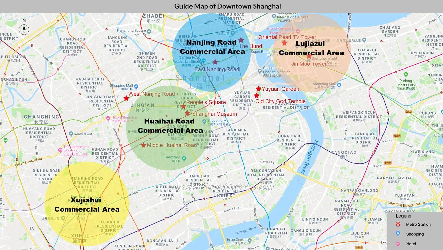
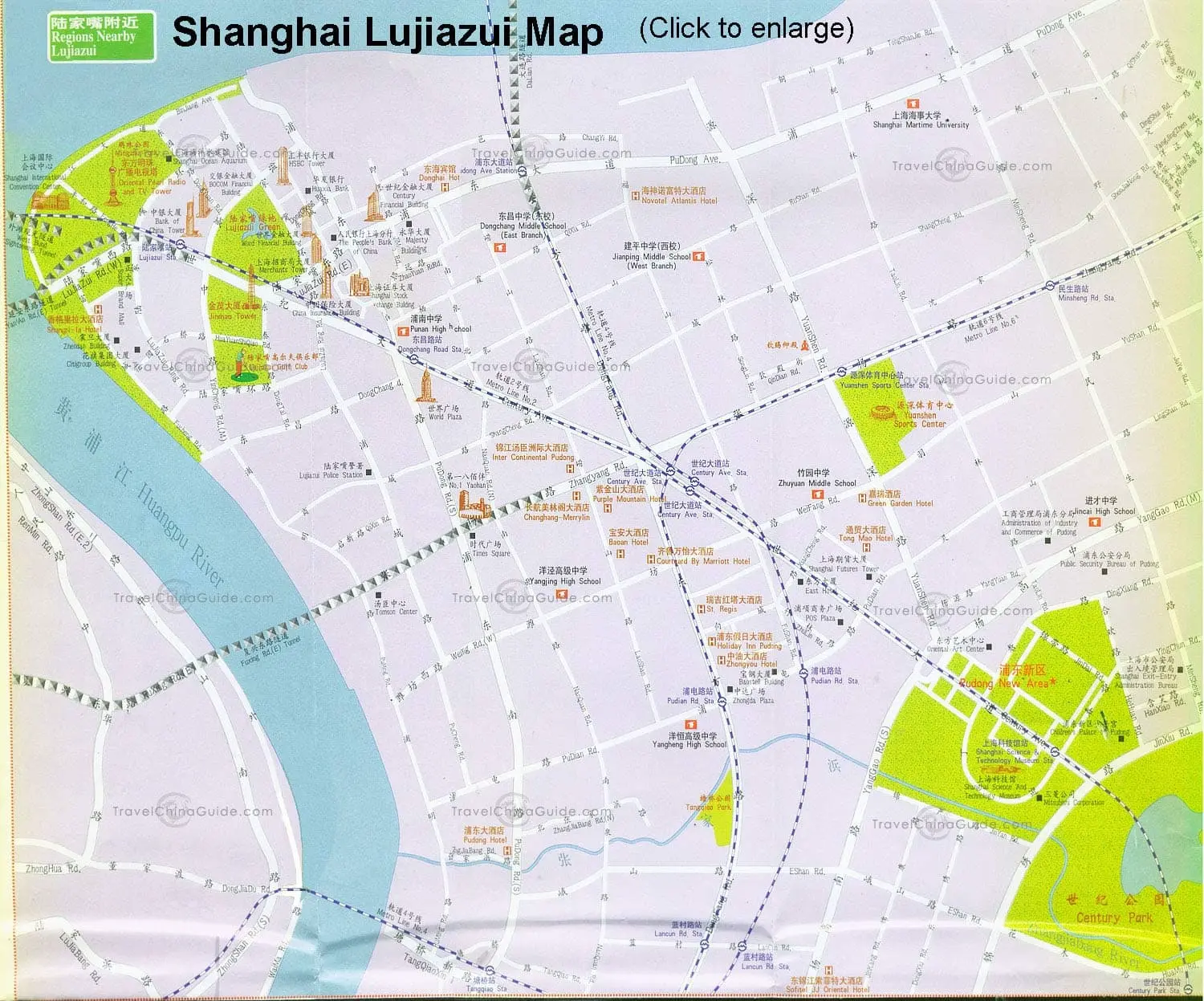
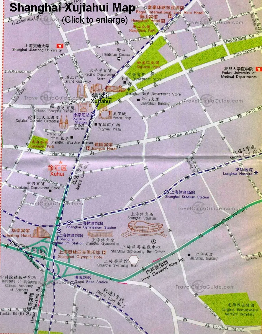
Shanghai Districts Maps
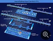
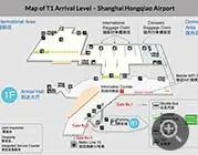
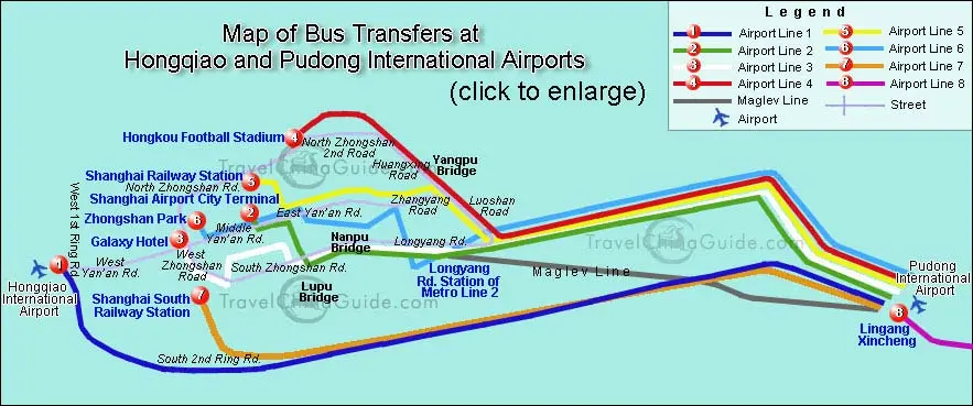
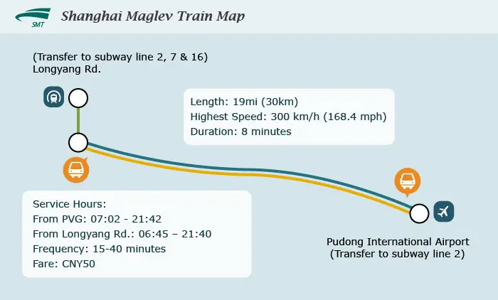
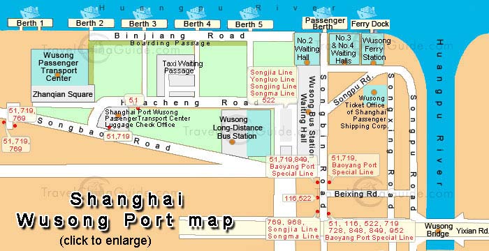
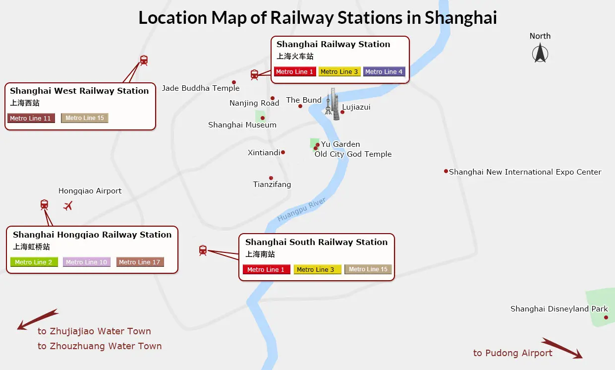
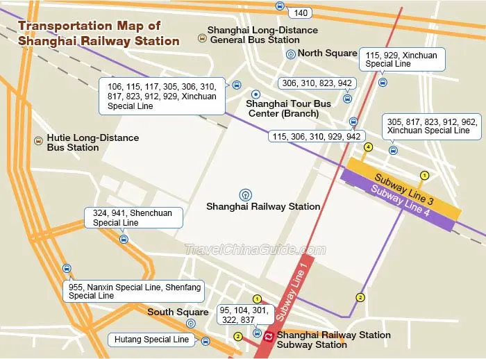
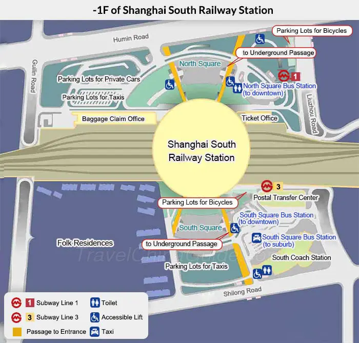
Transportation Maps
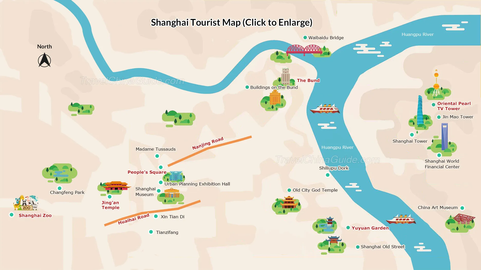
Shanghai Attractions Maps

- Last updated on Aug. 09, 2024 by Nancy He -
Questions & Answers on Shanghai Maps
Asked by Robyn from NEW ZEALAND | Oct. 27, 2024 16:34 Reply
Reply
Travelling to Suzhou Water town
How do we get there from No. 22, Lane 133, South Maoming Road, Huangpu District, Huangpu
Answers (1)
Answered by Rita | Oct. 28, 2024 02:15 0
0 0Reply
There are several water towns in Suzhou like Zhouzhuang and Tongli. Which one do you plan go?
Asked by Robyn from NZ | Oct. 27, 2024 16:32Reply
How far is from No. 22, Lane 133, South Maoming Road, Huangpu District, Huangpu to the French Quarte
Answers (1)
Answered by Emily | Oct. 28, 2024 02:1400Reply
It's a big area. You can take metro line 7 or line 2 to it. The most famous spot is Nanjing West Road Pedestrian Street.
Asked by Jugal kishore from INDIA | Nov. 27, 2023 04:22Reply
Information of subway
Which subway train is nearest to national convention exibition
Answers (1)
Answered by Helen | Nov. 28, 2023 18:1500Reply
Metro Line 2 and 17.
Asked by LeeAnne from CHINA | Jan. 10, 2023 16:33Reply
Coming from Hangzhou to Turn Garden
We will be arriving by train from Hangzhou, how do we get to Turn Gardens?
Answers (1)
Answered by Bruce | Jan. 10, 2023 17:1100Reply
I'm in Shanghai but haven't heard about Turn Gardens. Where is it? Are you mean Yuyuan Garden? If so and I suppose you will arrive at Hongqiao Railway Station, the you can directly take metro line 10 to Yuyuan Station, then follow the direction signs to the entrance.